News
Better decisions for migratory birds need the best information: How IBAT helps
Story | May 2024
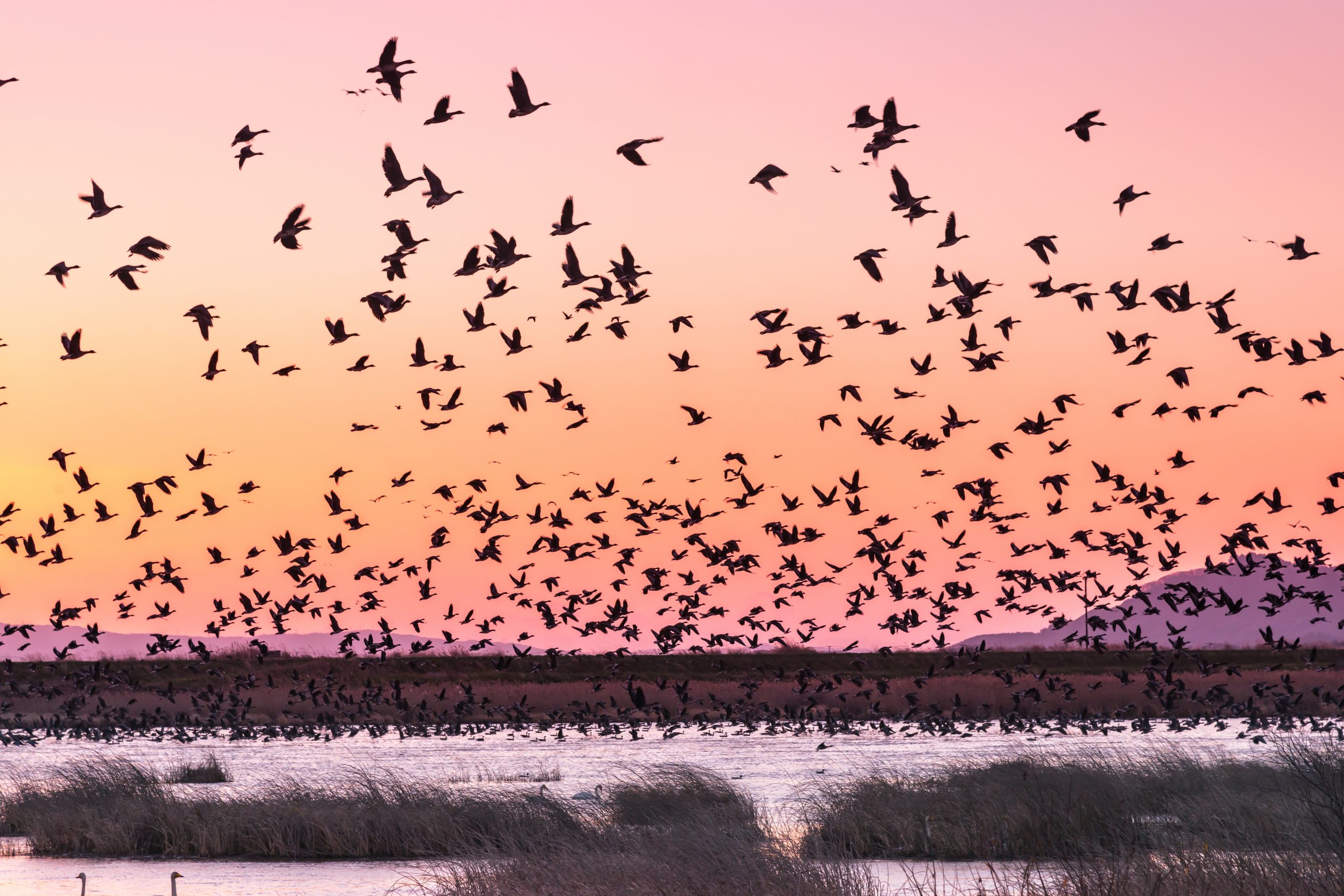
Earlier this year, the first comprehensive assessment of migratory animals shocked the world with the plight of the creatures that cross national boundaries and continents, some travelling thousands of miles, to feed and breed.
Nearly half of all migratory species that are recognised as needing protection have declining populations, according to the State of the World’s Migratory Species report released by the Convention on Migratory Species (CMS) and prepared by scientists from the UN Environment Programme World Conservation Monitoring Centre (UNEP-WCMC).
Birds are far the biggest group of species listed under the Convention on Migratory Species, with nearly 1,000 recognised as needing protection by CMS Parties. Fourteen per cent of these are globally Threatened.
The report states that conserving the movements of migratory species such as birds requires spatial and developmental planning and policies, guided by research and mapping. To help with this, the Integrated Biodiversity Assessment Tool (IBAT) allows decision-makers to make sure their plans consider biodiversity, such as by avoiding and mitigating barriers to migratory animals’ journeys. The online platform provides access to information from three of the world’s most authoritative biodiversity datasets: the World Database on Protected Areas (WDPA), World Database of Key Biodiversity Areas (WD-KBA), and the IUCN Red List of Threatened Species.
Here, we show how IBAT can be used to generate key data for three important sites for migratory birds.
The Camargue – France
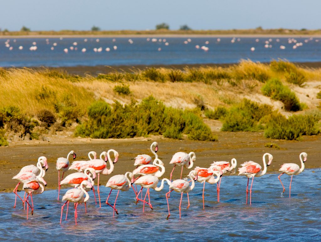
The Camargue in southern France is the country’s largest wetland and one of its most important sites for birds. Every year, tens of thousands of migrating birds, including the only flamingos to nest in France, flock here. Tufted ducks, shovelers, pintails, wigeons and teals are among the species that stop to feed and rest on their journeys between Africa, Europe and the Mediterranean.
IBAT shows that the Camargue is an area of tremendous value for biodiversity, visualising how multiple protected areas and Key Biodiversity Areas overlap (see image 1 in the graphic below). Despite its importance for migratory birds and numerous protections, the Camargue and its biodiversity is under pressure. The factsheet for this Key Biodiversity Area, which IBAT provides a direct link to, identifies the development of rice fields and pollution from agriculture and chemical plants as threats.
The CMS State of the World’s Migratory Species report found that ‘agriculture and aquaculture’ is the second most prevalent threat affecting CMS-listed birds and migratory insects, as it can cause habitat loss and degradation. The report also highlights that pollution affects 40 per cent of migratory birds. Agricultural and industrial activity can release toxic chemicals, such as persistent organic pollutants, into the environment, with nutrient run-off posing a serious threat to wetland birds and their habitats.
Hunting is another pressure on the Camargue. The State of the World’s Migratory Species report found that poisoning from spent lead ammunition has a significant impact on many migratory raptors and waterbirds, as they can consume lead when feeding. Although it is illegal to use lead gunshot around wetlands in EU countries, about one million waterbirds are still estimated to die from lead poisoning every year in Europe. Studies indicate that banning lead ammunition in parts of the Camargue since the early 1990s has reduced the amount of contamination, although the persistence of the toxic metal in many waterfowl shows that the law is still not being strictly applied.

However, a powerful function of IBAT is that it can inform decisions by businesses, governments, civil society and others to halt global extinctions. The Species Threat Abatement and Restoration Metric (STAR), shown in image 4 above quantifies the potential contributions that activities to reduce threats and increase restoration would have on reducing the global risk to threatened species, and can help decision-makers to identify actions.
For the Camargue, both threat abatement and restoration activities could make a high contribution to reducing the risk of threatened species becoming extinct. Examples of threat abatement activity could include regulating fertiliser use and eliminating the use of lead shot; restoration activities might be rehabilitating reed beds and turning salt pans back into lagoons, marshes and dunes.
Taveuni Island - Fiji

The archipelago of Fiji in the South Pacific Ocean is an important stopover and nesting point for a number of migratory seabirds, such as collared, Fiji and Tahiti petrels. These birds are Vulnerable, Critically Endangered and Near-Threatened, respectively, but are not yet listed in the CMS Appendices. The State of the World’s Migratory Species report highlights that many species of albatrosses, petrels and shearwaters are some of the most Threatened animals that are not yet recognised by CMS Parties as needing international protection.
Zooming in on Fiji’s “Garden Island” of Taveuni in IBAT helps to understand its rich biodiversity, how it is currently protected and how species may be better helped in the future. Key Biodiversity Area data from BirdLife International, an IBAT Alliance partner, shows that the island and surrounding sea are both Important Bird and Biodiversity Areas (image 1 of the graphic below). Further, IBAT’s Rarity-weighted richness data layer (image 3) reveals it abounds in a large number of rare species, and is the last remaining refuge for one or more Endangered or Critically Endangered Species.
The Key Biodiversity Areas data layer allows us to identify the Important Bird and Biodiversity Area that encircles Taveuni Island as “Taveuni Marine” – which is linked to more information about the site. Threats to the Taveuni Marine include pollution, climate change and severe weather, and fishing. The State of the World’s Migratory Species report points out that: “Bycatch remains one of the most significant threats to seabirds” and that “the effects are particularly serious for Albatrosses and Petrels”. Measures such as bird-scaring lines, night-setting and line-weights have reduced bycatch levels substantially in some key longline and trawl fisheries.
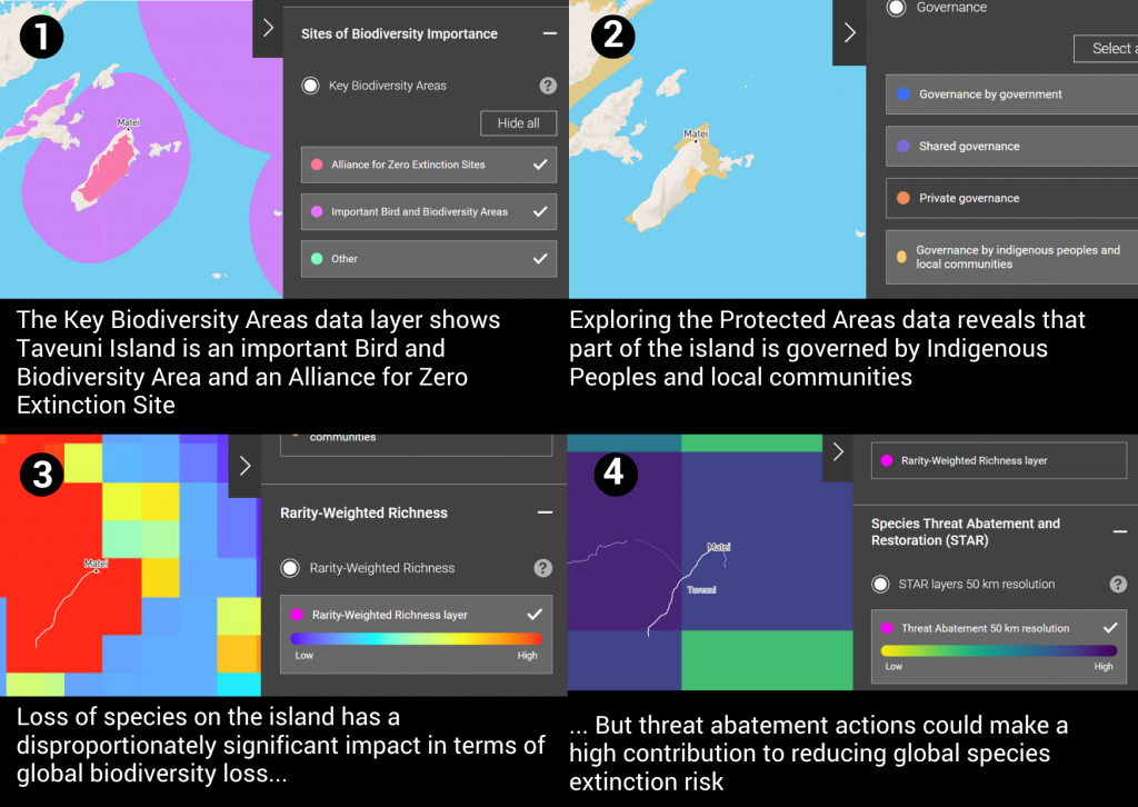
Using IBAT’s report-generating functionalities, users find that there are 240 Critically Endangered species within 50 km of the site. Threat abatement activities (image 4) could contribute greatly to reducing the risks to endangered animals. Threat abatement activities could include removing invasive species such as rats and cats, which prey on Fiji petrels and Tahiti petrels at their nesting sites and are listed as one of the threats to both species. Similarly, restoration activities could make a strong contribution, particularly in the north of the island.
Furthermore, IBAT shows that not only is Taveuni Island an Important Bird and Biodiversity Area, but that it also has multiple terrestrial, coastal, and marine areas that are designated and managed as protected areas by Indigenous Peoples and local communities (image 2).
Fakim Wildlife Sanctuary, India
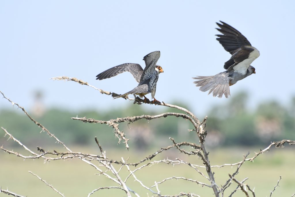
Close to the border between India and Myanmar in the eastern Himalayas, Fakim Wildlife Sanctuary sits in a mountainous biodiversity hotspot home to iconic and Endangered animals such as tigers and yellow-headed tortoises. It is also one of the spots in northeastern India where vast flocks of Amur falcons stop over for around a month during their long journeys between their breeding grounds in Russia and China, and where they winter in southern Africa.
As is often the case around the world, there is much that is not known about how effectively Fakim Wildlife Sanctuary is being protected, and the area is not yet reported to the World Database on Protected Areas (WDPA) (see image 1 of the graphic below).
The Protected Planet team at UNEP-WCMC, who manage the WDPA, work continually to build relationships and work closely with data providers with the aim of further increasing the accuracy of this resource.
One of IBAT’s unique attributes is the investment it provides for maintaining and updating the tool’s core global biodiversity datasets and derived layers. Biodiversity data can be sparse, so the broad array of data provided through IBAT can help shine a light on important sites for biodiversity when the coverage of singular datasets is limited in some way. In the case of Fakim Wildlife Sanctuary, the Rarity-Weighted Richness data layer highlights the area as being of great biological significance (image 2). Threat abatement actions would have a globally meaningful impact (image 3), further signalling that the area should be considered ecologically important and sensitive.
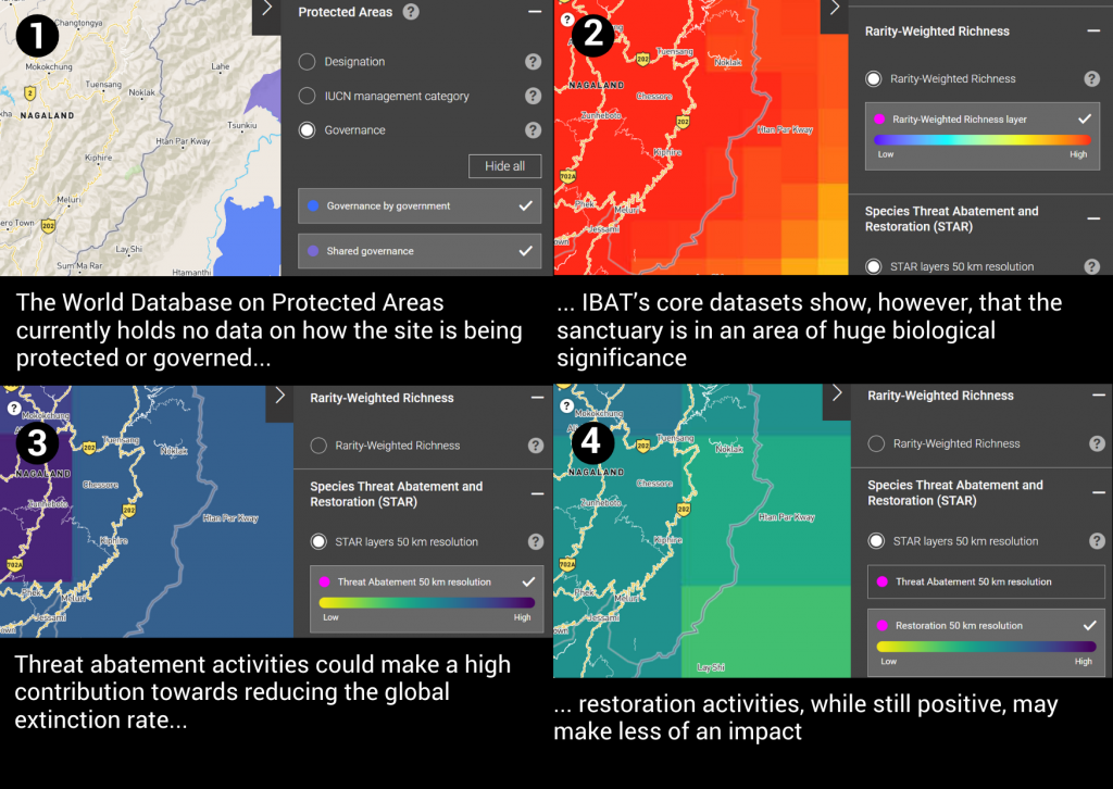
An example of threat abatement action could be initiatives on unsustainable hunting. The KBA factsheet for the Fakim Wildlife Sanctuary and Saramati area identifies the intentional hunting and collecting of animals as an ongoing threat to Fakim Wildlife Sanctuary. The State of the World’s Migratory Species report points out that “Hunting for food, sport and other purposes is… a pervasive threat to the many migratory birds that use the East Asian-Australasian flyway or migrate between Africa and Europe”, and that due to lack of coordinated monitoring across different countries, the impact of both legal and illegal hunting cannot always be reliably assessed at the population or flyway level.
In good news for the Amur falcons that pass through the sanctuary, in the past 10 years there have been significant efforts by local authorities, religious leaders and youth groups to find alternative livelihood sources for people, such as tourism. A number of village councils banned the trapping and killing of birds, and despite the hardships of the Covid-19 lockdowns, no instances of mass killing of the birds was reported.
The Integrated Biodiversity Assessment Tool is a phenomenal one-stop-shop that allows users to pull together the most authoritative data available on the natural world. Allowing users to look at site-level detail in granular detail means they can profile some of the world’s most biologically sensitive and important areas, such as those migratory birds depend on, so that companies, organisations and governments can take nature into account when making decisions.
IBAT’s functionalities are not limited to its open and free biodiversity maps: it also offers added-value paid-for services such as reports, packaged data downloads and web services, all designed to make it easy for users to assess their impact on the natural world.
Edward Ellis, Business Manager for the Integrated Biodiversity Assessment Tool
Main image: AdobeStock_250776334
Have a query?
Contact us
communications@unep-wcmc.org
